Root-XMAS 2024 Day 13 - The lost gift
# summary
Some OSINT with a pcap file to find the trajectory of a drone, and it's last picture to guess the correct road on Google Maps.
# Solution
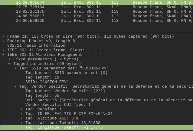
We open the pcap file and are immediately greeted with Broadcast frames showing the location of the drone. Drones broadcast RemoteID frames via Wifi and Bluetooth as a safety measure.
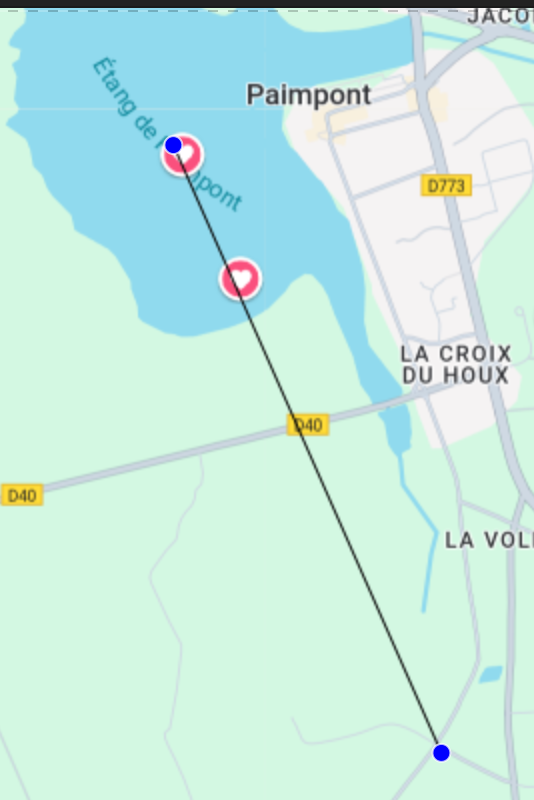
We copy paste the few last know locations and search on Google maps… last known location is in the middle of a lake in Britanny! (I went there, It's Brocéliande, a beautiful place)! But the last image of the drone was a road intersection. We know the drone continued it's path on a straight line. So let's trace it!
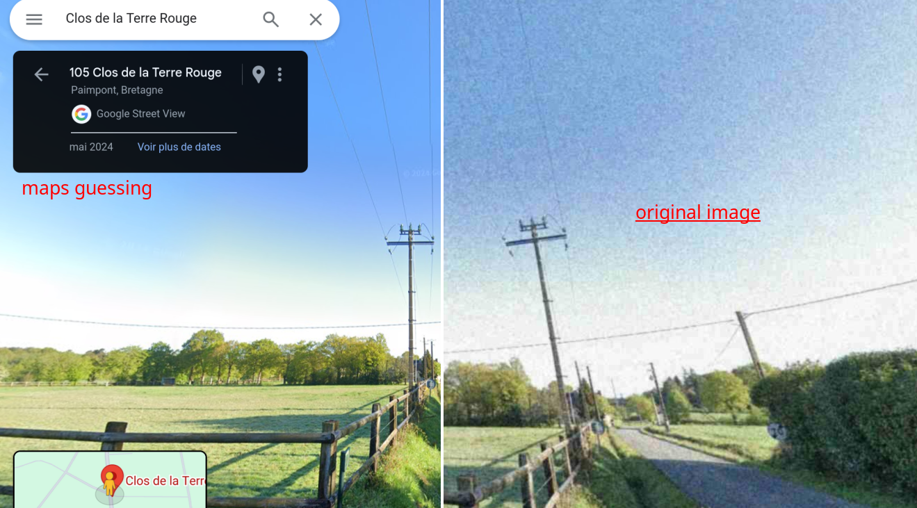
We the have very similar images… not surprising as the "drone image" had a Google Maps watermark on it ^^'
Careful, we landed just on the small road of the intersection, not the main one!
"RM{"+ "Clos de la Terre Rouge".lower().replace(" ","") + "}"
	RM{closdelaterrerouge}
| Previous day | Day 12 - The Naughty SnowmanDay 12 - The Naughty Snowman |
|---|---|
| Next day | Day 14 - Almost a GiftDay 14 - Almost a Gift |